Did the River Murray Ever Cross the Mount Lofty Ranges?
A theory as old as the hills – but how old is that, exactly?
The Problem of Morgan
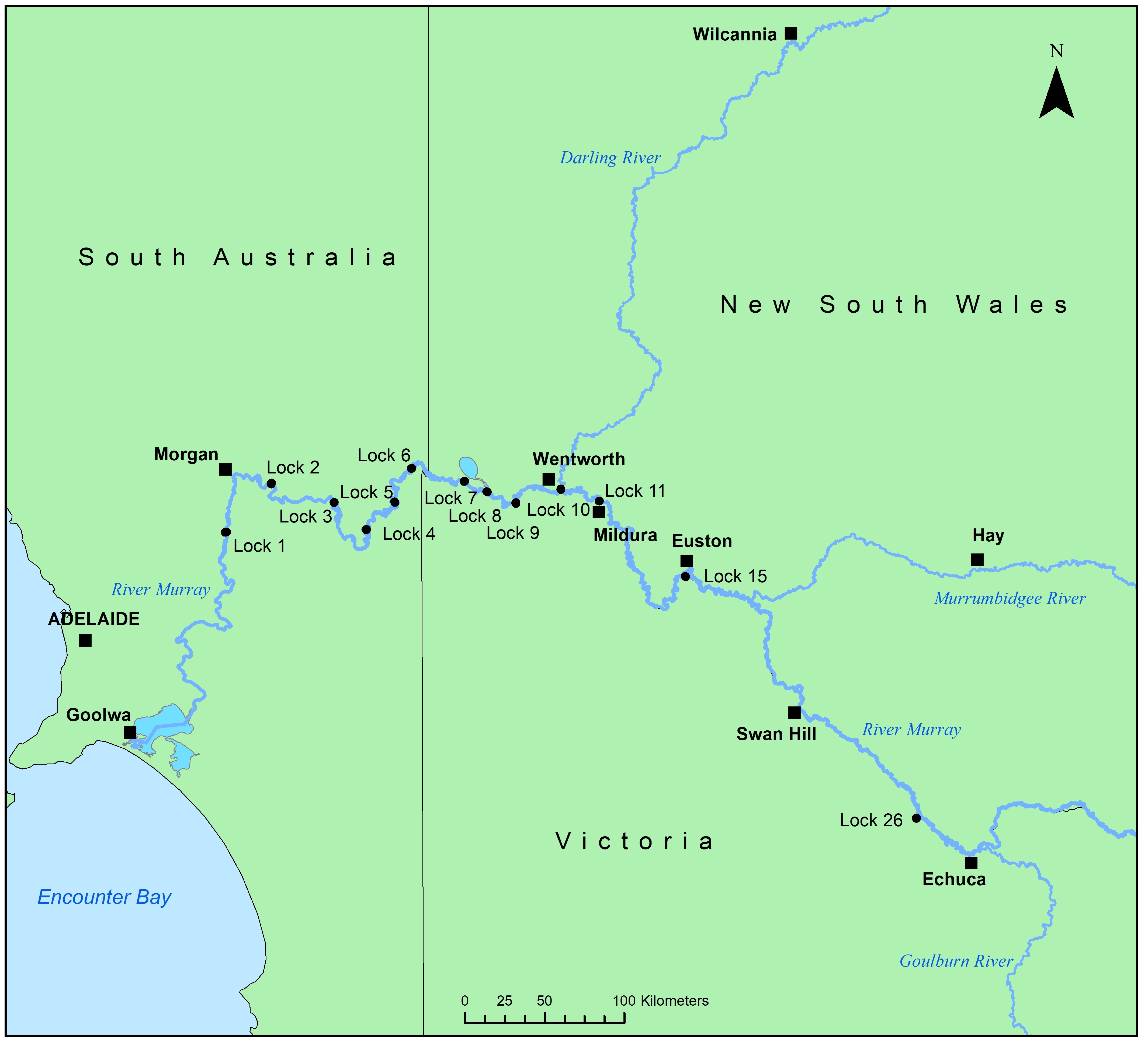
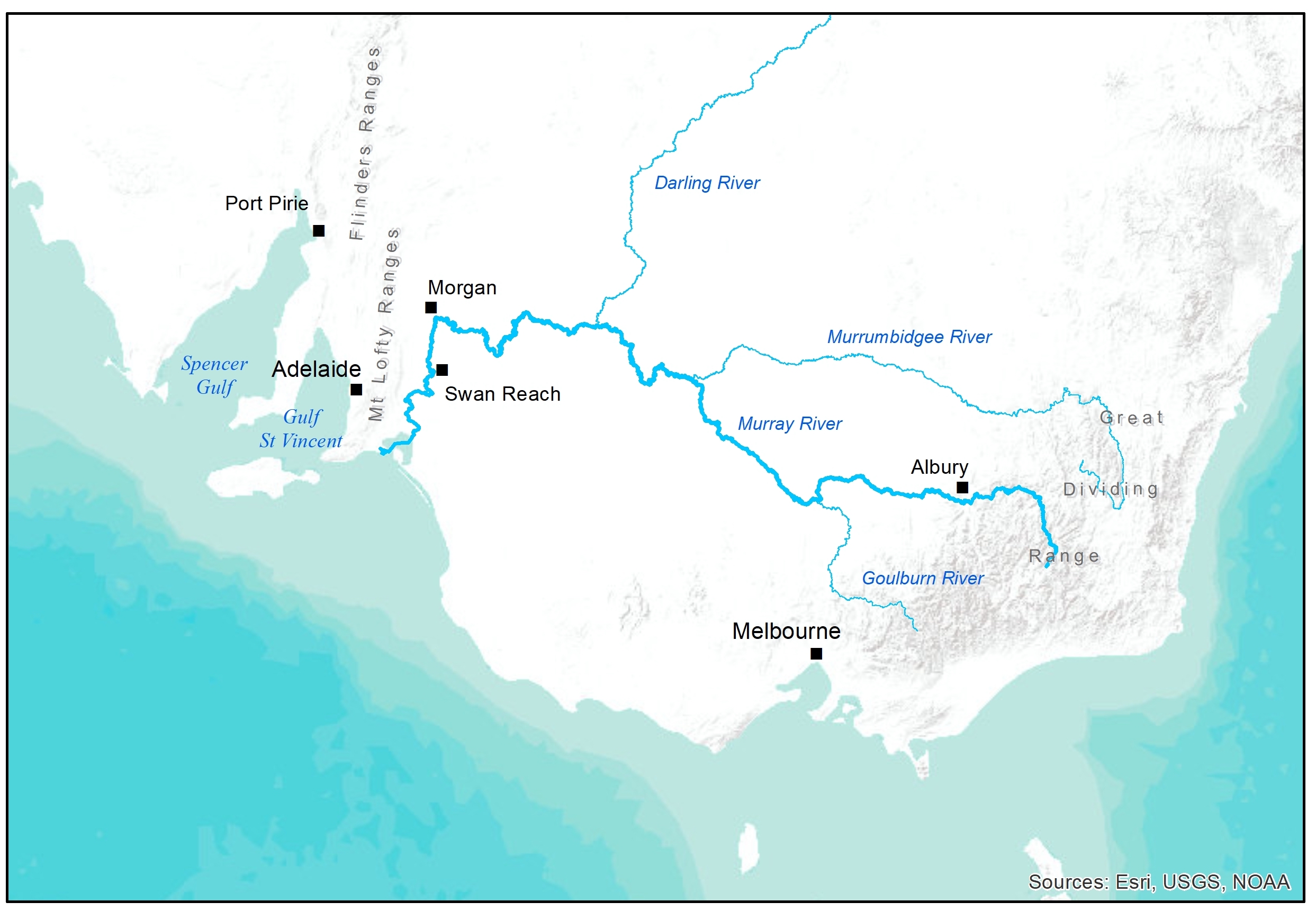
The River Murray descends from the Great Dividing Range at Albury, and for the next 800km follows a fairly steady northwest course.
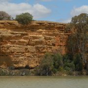
That changes at Morgan, where the river makes a sharp left turn towards Goolwa and the sea.
The bend at Morgan has been attributed to the Morgan Fault, which lies just west of the river. But if the fault created the bend, where did the river go before the fault was formed?
Did it keep going, and where to?
A western route for the river seems crazy, not least because just west of Morgan lies the impassable barrier of the Mount Lofty Ranges. But a western route was proposed by Williams and Goode in 1978 who searched the ranges for the abandoned river all the way to Spencer Gulf.
The Route Across the Ranges
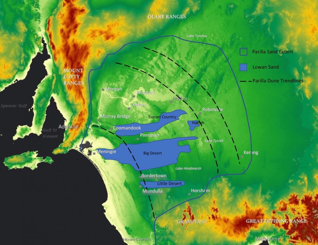
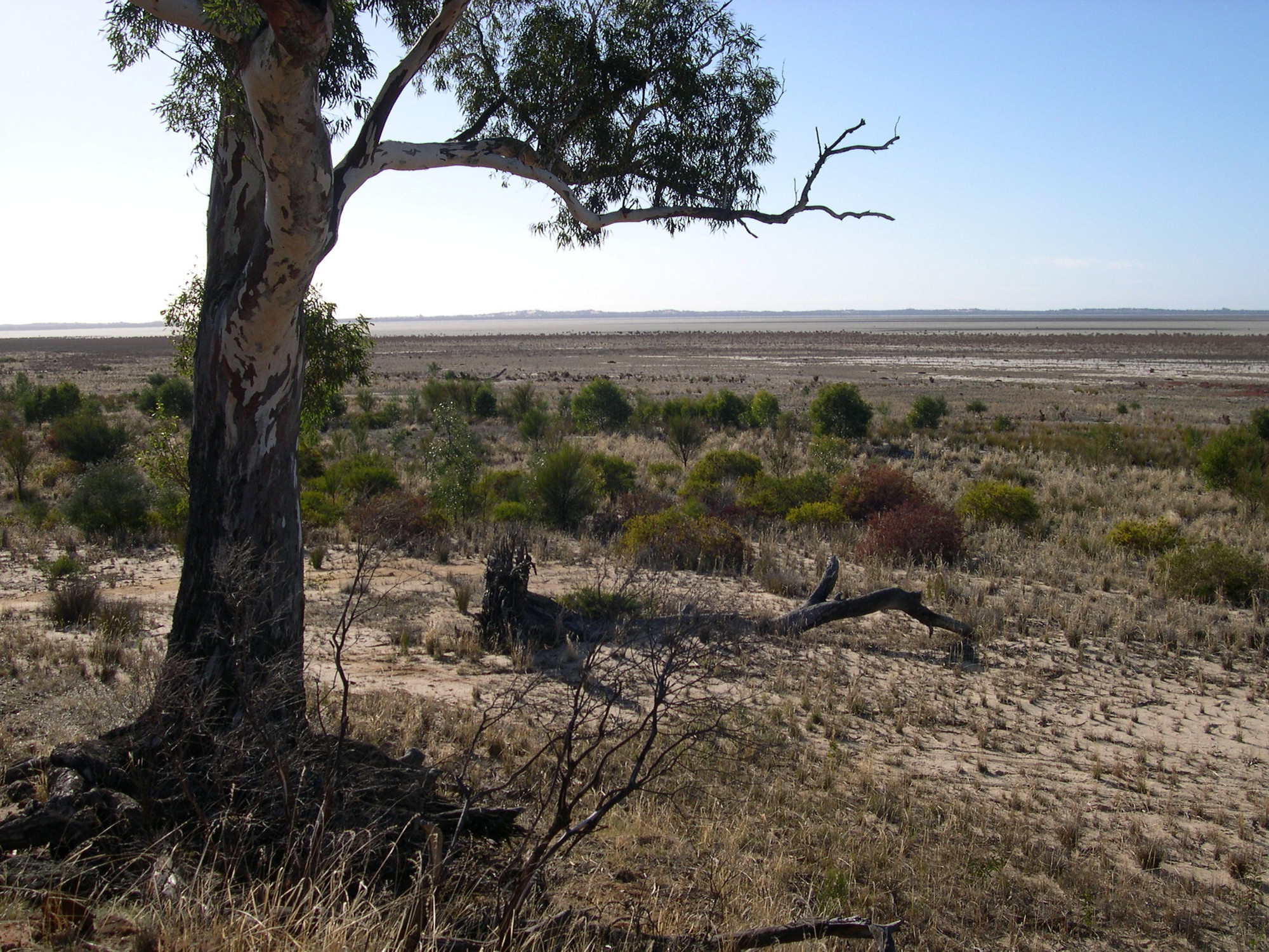
The western route theory proposes that before the Mount Lofty Ranges were formed, the River Murray continued northwest and discharged to Spencer Gulf. The river was defeated when the ranges were raised and flow was deflected south by the Morgan Fault. Clues to the original route can still be found across the landscape.
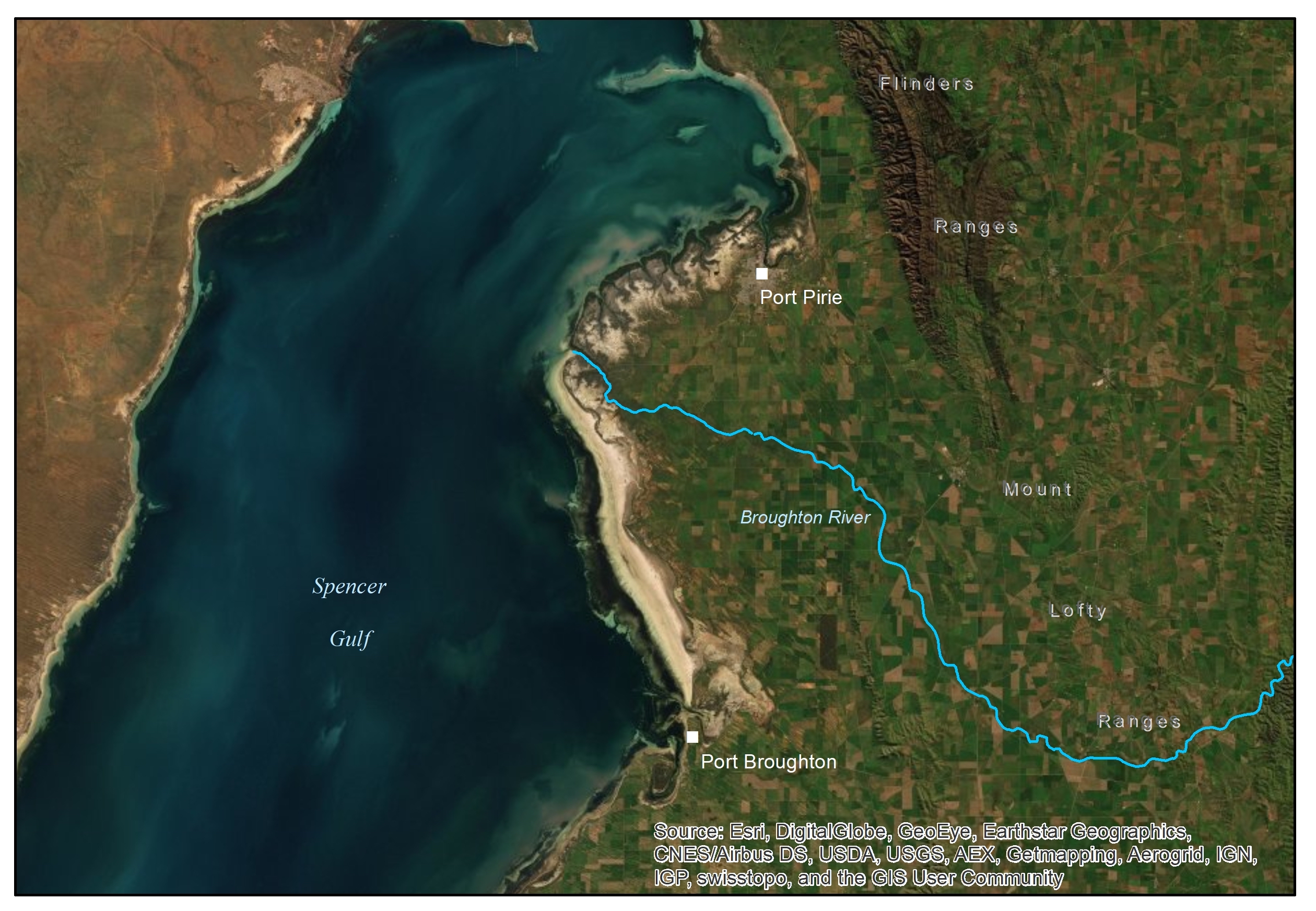
The first clue lies in Burra Creek, a small ephemeral stream that drains the western Mount Lofty Ranges and joins the Murray at Morgan. The alignment of the creek is key, because it continues northwest beyond Morgan. Could this be the former channel of the Murray, now flowing in reverse?

The second clue is in the ranges. Burra Creek lines up with the Broughton River, which continues the northwest route on the other side of the range.
The shape of the Broughton River channel is peculiar. Today it is a small, seasonal watercourse – not much more than a creek. But it flows through a channel that is very broad and deep, indicating it was once the course of a major drainage system.
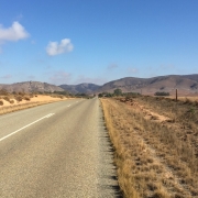
The Broughton River near Spalding
The final clue is in the gulf, where the Broughton River snakes its way across an oversized delta. Although the river small and seasonal, its delta stretches 40 km from Port Pirie to Port Broughton and bulges 18 km into the sea. According to the theory, this is the ancient mouth of the River Murray.
Debunking the Theory
The western route of the River Murray was always hard to believe, but that doesn’t make it easy to disprove. The theory hinged on the River Murray being older than the ranges which, even in 1978, was not clear. It took another 10 years to sort things out.
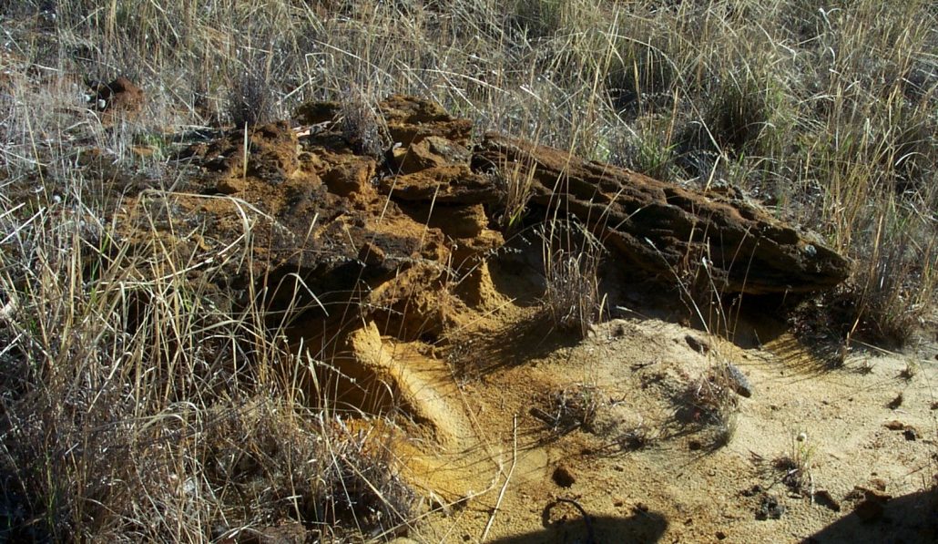
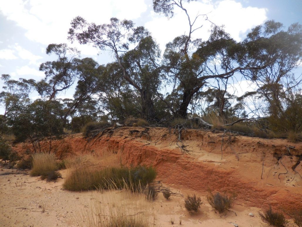
The Murray Basin formed when Australia separated from Antarctica, 50 million years ago. The sediments that first filled the basin, and have filled it ever since, stop at the foot of the ranges. Therefore ranges have always presented a barrier at the western extent of the Murray Basin.
The sediments washing off the ranges also indicate their age. These date back at least to the Eocene.
As far as the Broughton River delta goes, it’s big, but it isn’t big enough. If you compare it with the vast volumes of sediment carried by the Murray drainage system, the delta is far too small. In fact, the Broughton River delta isn’t much bigger than similar alluvial deposits from the ranges at Noarlunga and Willunga. In the past the Broughton River drained a wetter catchment and would have carried more sediment. And the shallow floor of the gulf contributes to the delta’s broad extent.
In the same way, the oversized channel of the Broughton River is more easily explained by a wetter climate in the geological past than by a westerly flowing River Murray.
So What does the Bend at Morgan Mean?
More recent work has shown that the course of the River Murray through South Australia is actually quite new.
Previously, the Murray Basin drained through the Douglas Depression in western Victoria and reached the sea near Portland. This route was blocked by faulting 2.4 million years ago, which dammed the Basin and created the vast freshwater Lake Bungunnia.
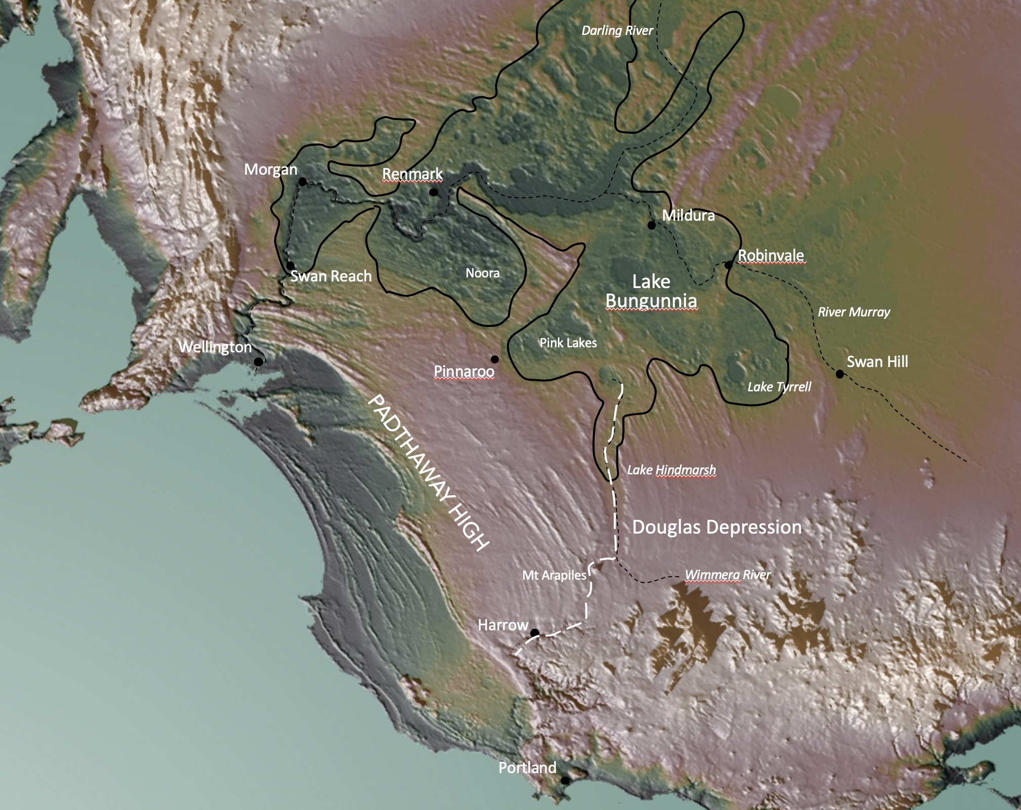
Adapted from McLaren et al. (2011)
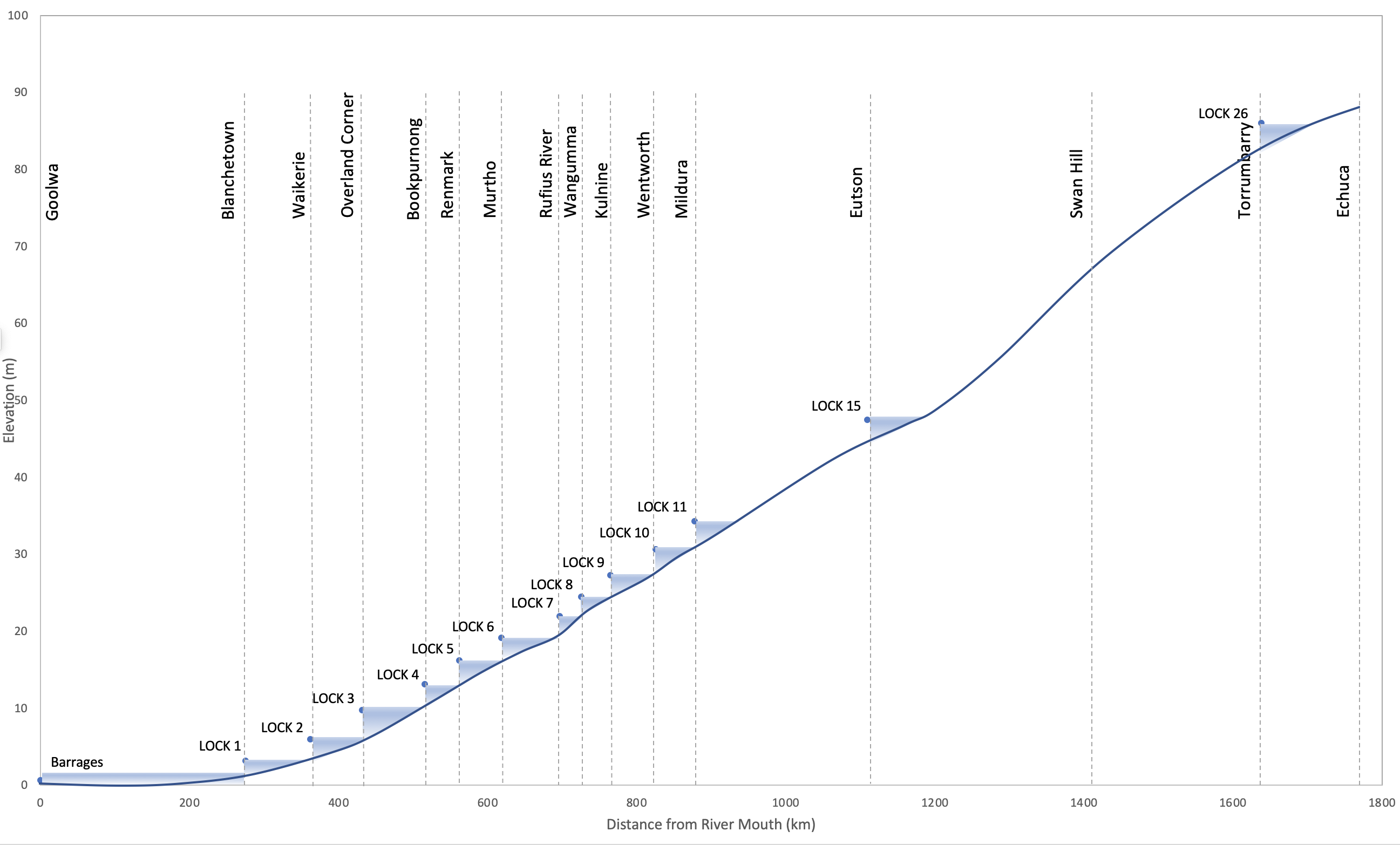
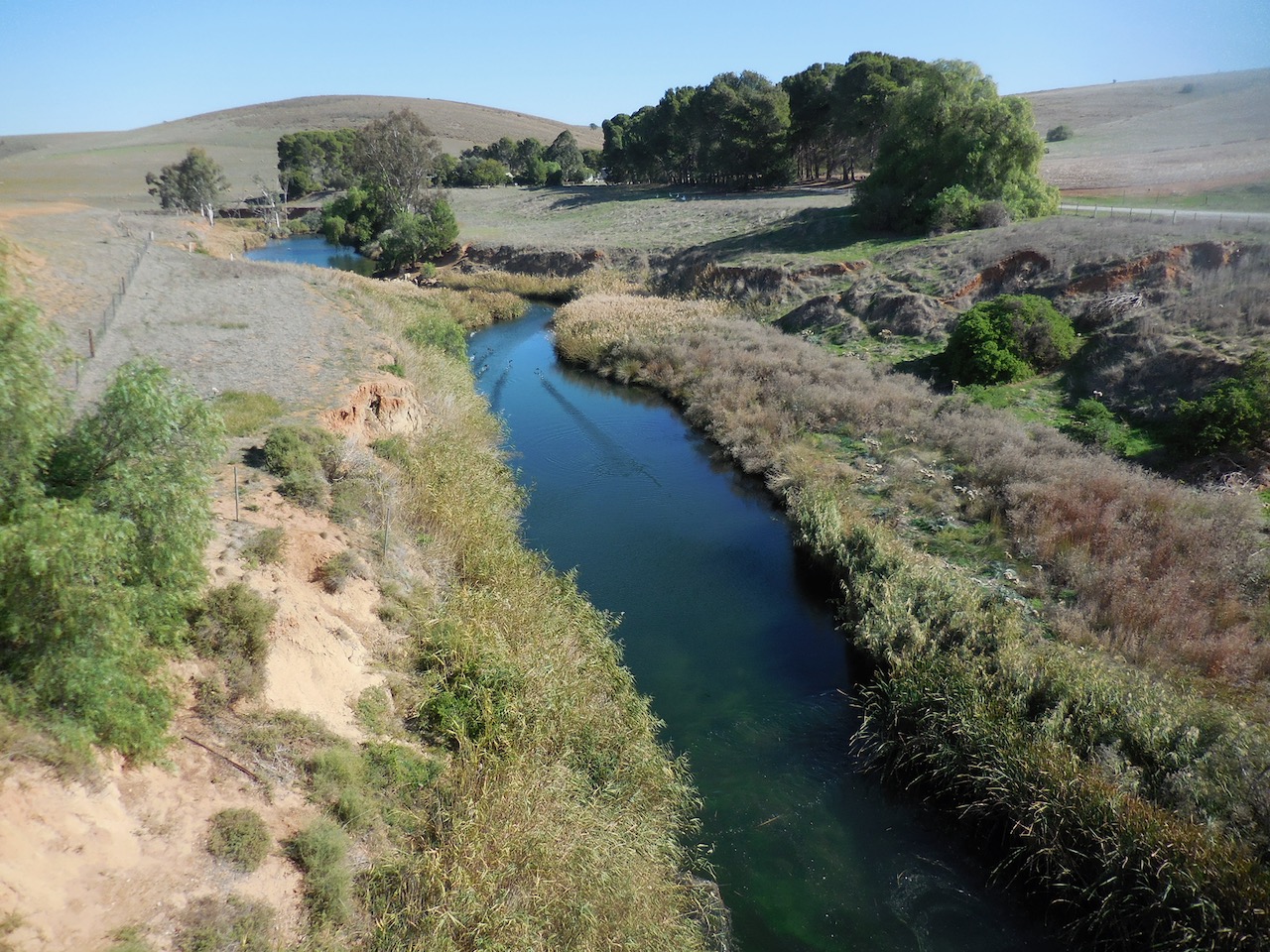
The present day route of the Murray formed only 700,000 years ago when Lake Bungunnia was breached. Water spilt southwards from the lake at Swan Reach and carved the Murray Gorge.
Having cut a route downstream, the gorge continued to erode upstream towards Morgan. This route was probably guided by fractures in the underlying limestone that run parallel to the Morgan Fault.
So the deflection of the Murray River at Morgan is an illusion. It doesn’t represent the redirection of a flow moving downstream, but rather the path of the river channel eroding upstream.
References and Further Reading
McLaren, S., Wallace, M.W. and Reynolds, T. (2012). The Late Pleistocene evolution of palaeo megalake Bungunnia, southeastern Australia: A sedimentary record of fluctuating lake dynamics, climate change and the formation of the modern Murray River. Palaeogeography, Palaeoclimatology, Palaeoecology 317-318: 114-127.
Stephenson, A.E. and Brown, C.M. (1989). The ancient Murray River system. BMR Journal of Australian Geology and Geophysics 11: 387-395.
Twidale, C.R, and Bourne, J.A. (2009). Course of the lower River Murray in South Australia: effects of underprinting and neotectonics? Proceedings of the Royal Society of Victoria 121: 207-227.
Williams, G.E. and Goode, A.D.T. (1978). Possible western outlet for an ancient Murray River in South Australia. Search 9: 442-447.